View basket “Course of the Danube from the Black sea to Constantinople, 1860s” has been added to your basket.
Sale!
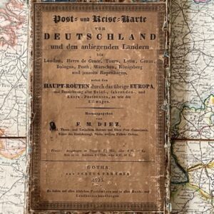
A post map of Europe including England, France, Germany, Italy. &c. Mid 19th century
£120.00£100.00
Post Map of Europe comprehending England, France, Germany, Italy &c. With the Posts. Distances, Roads, Railways, Packet Routes, &c. James Wyld [London].
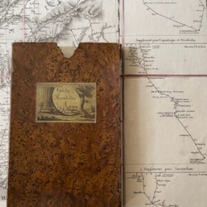
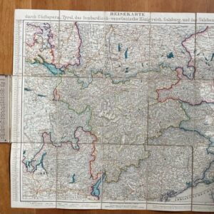
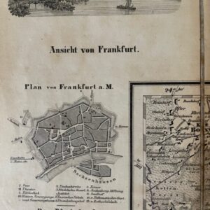
Large folding map, dissected, linen backed, coloured in outline, unfolded size 34ins x 47ins. The map is in generally clean condition, it folds, 40 plates, to a size of 9ins x 4.5ins and retains its original green cloth covered slipcase with printed publisher’s label, generel wear and rubbing to case, label grubby with some small areas of loss, original matching cloth endpapers to the map, the face of which remains lean and fresh and there are no holes to the linen folds, The map extends in the west from the Bay of Biscay and Lands End to Warsaw and Cracow [Kraców] in the east and from Durham, the Isle of Man and Weden in the north to Montpellier, Carcassonne, Lucca and Florence in the south. An attractive map showing mid 19th century Europe. There is no date on the map but Wyld’s position as Geographer to Prince Albert means a date before the Prince Consort’s death in 1861.