

")


")
")
")
EUROPE. A large folding map of 1836 with French text.
£40.00
Carte Itinéraire De l’Europe Indiquant Les Limites Actuelles Des Etats. Dédiée Au Roi…1836. Chles. Simonneau Paris, 1836.
Folding map. dissected, linen backed, coloured in outline, extending to a size of 27 x 50ins [950 x 1250mm.The map folds down in 32 plates to a size of 9 x 6ins [240 x 160mm] into its original green paper endpapers and fits into a marching green slipcase. The slipcase is worn with some damage and the card base is lacking: it has a printed label EUROPE and on that is a contemporary ownership name in ink Lady May. The map is reasonably clean but has some discolouration along folds and there are small holes in the linen at the intersections of folds. The map includes the whole of the United Kingdom and Spain in the west and extends to the eastern coast of the Black Sea in the east. may16/3
1 in stock
Related products
-
Sale!
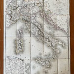
ITALY. A route map of Italy, published in Paris in 1824
£190.00£170.00 Add to basket -
Sale!
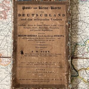
GERMANY. Folding map by F.M. Diez in original slipcase, 1825
£125.00£110.00 Add to basket -
Sale!
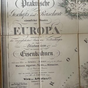
European Railway map, Vienna 1861
£165.00£150.00 Add to basket -
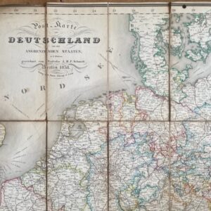
Germany, an 1838 folding map of the area and bordering states.
£95.00 Add to basket