


Map of route from Dongola to Khartum with Kitchener’s Report, 1884
£80.00
The Nile. Large scale map from Dongola to Khartum. Scale 16 Miles to an inch. Edward Stanford [London] . With Major Kitchener’s Report. 1884
Folding map printed on paper with the Nile shown in blue, on a scale of 16 miles to 1 inch [22 x 28ins unfolded]. The map folds down to a size of 7 x 4.5ins and retains the original printed Stanford’s endpapers, the front with title and rear with advertisement and description of the smaller scale map of Equatorial Lakes to the Mediterranean. Interestingly this copy retains the original tipped in 4pp Major Kitchener’s Report 1884, which gives details of four routes [Debbah to Khartum, Ambukel to Wady Bishara, Merawi to Berber,Ambukel to Mettemeh]. The map is clean but there are some edge tears without loss and some holes at the intersections of folds, and spluts along folds. The map margin notes that it was published on Oct 24th 1884. feb27/1
1 in stock
Related products
-
Sale!
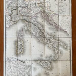
ITALY. A route map of Italy, published in Paris in 1824
£190.00£170.00 Add to cart -
Sale!

Champagne and Brie. A large two sheet French map by Bazin, 1790.
£230.00£200.00 Add to cart -
Sale!
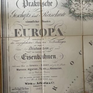
European Railway map, Vienna 1861
£165.00£150.00 Add to cart -
Sale!
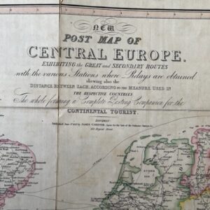
CENTRAL EUROPE. A George IV period post map for the Continental Traveller, 1827
£150.00£130.00 Add to cart