

")
")
")

Russia in Europe, sheet 2 showing the lower half in the Napoleonic period 1806-8
£225.00
The Russian Dominians in Europe drawn from the latest Maps printed by the Academy of Sciences, St. Petersburg; revised and corrected with the Post Roads & New Governments, from the RussianAtlas of 1806; by Jasper Nantial. Published by W FADEN. Charing Cross [London] June 4th 1808.
A large and attractive folded map, dissected and linen-backed, coloured in outline and extending to 37 x 22 inches [94 x 56 cm] and folding down to 11 x 7½ ins [28 x 19 cm]. The map extends from the western coast of the Black Sea to the Sea of Aral in the east and from Smolensk and Moscow in the north to Georgia in the south. There are a few small holes and splits to the linen . The back has a stamp No. 2. The map covers much of the territory currently attracting political and military attention. nov22/5
1 in stock
Related products
-
Sale!

European Railway map, Vienna 1861
£165.00£150.00 Add to cart -
Sale!
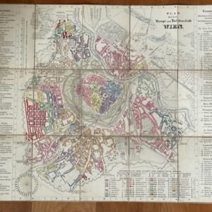
Folding, coloured city plan of Vienna, c 1830s
£180.00£160.00 Add to cart -
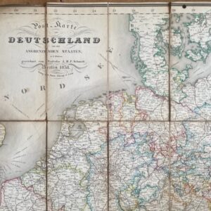
Germany, an 1838 folding map of the area and bordering states.
£95.00 Add to cart -
Sale!
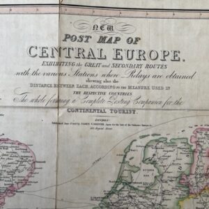
CENTRAL EUROPE. A George IV period post map for the Continental Traveller, 1827
£150.00£130.00 Add to cart