


")
RUTLAND. Folding map of 1804, corrected to 1808
POA
A new Map of the County of Rutland divided into Hundreds. C. Smith [London] 1804 2nd edition corrected to 1808.
Folding, dissected and linen mounted map with hand colouring, 20¾ x 18½ ins unfolded, on a scale of approximately 1 inch to 1 mile. The map folds down to a size of 6¾ x 4¾ ins and has a cut out printed title RUTLAND pasted to the endpaper. The map is quite clean and the colours are still fresh. A handsome map of England’s smallest county. mar20/1 SOLD 16th July 2024
Sold
Related products
-
Sale!
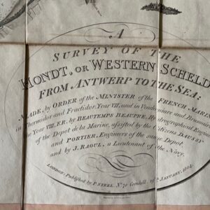
Survey of the Western Scheldt, published in London 1804
£775.00£690.00 Add to basket -
Sale!
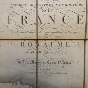
FRANCE. A folding route map of 1828
£125.00£110.00 Add to basket -
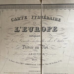
EUROPE. A large folding map of 1836 with French text.
£40.00 Add to basket -
Sale!
A Louis XVIII post restoration folding map of France, 1818
£265.00£230.00 Add to basket