

")
")
")
")
")
")
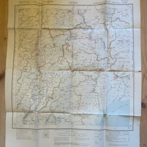
GARHWAL & ALMORA 1 inch map of 1873 in use by a hunter in 1946
£55.00
Thuillier, Colonel H. L.. C.S.I., F.R.S. Surveyor General: United Provinces, India. Parts of Districts Almora & Garhwal. Folding Map No 53 O/9 & 13 (Old No. 248) Season 1871-72. Survey of India [Calcutta] 1873.
Folding black and white map, dissected, linen backed, 35½ x 21 ins on a scale of 1 mile to 1 inch, folding down to a size of 12 x 8ins with cloth endpapers retaining printed label. There is some old writing on parts of the map in red and blue ink showing its use on a hunting or shikari trip based on Bageswar on the Sarju River dated June 1946, Sep/Oct 1946. oct27/4 RESERVED 23rd July 2026
It is a tribute to the very high standard of 19th century surveying in India that these maps were still in practical use by travellers and big game hunters 70 years later.
1 in stock
Related products
-
BURMA. Folded paper map No. 85 P MA-UBIN Survey of India 1926
£20.00 Add to cart -
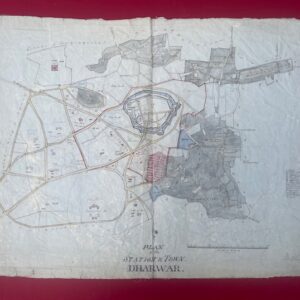
DHARWAR. Hand drawn detailed map of an Indian military station , circa 1850/60.
£500.00 Add to cart -
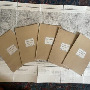
United Provinces of Agra & Oudh. Six large scale folding maps of Almora District. c.1870s/80s
£160.00 Add to cart -
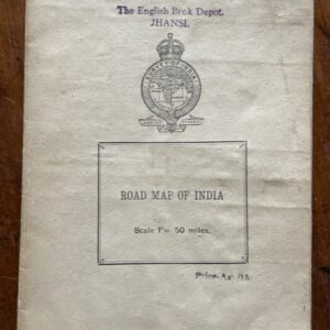
INDIA. Road map on a scale of 1 inch to 50 miles, printed around the time of independence
POA Read more