


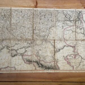
AFGHANISTAN. A damaged folding map from the period of the 1st Anglo-Afghan War, 1838
£15.00
A folding map taken from a book published in 1838 by Richard Bentley, extending unfolded to 31½ x 25 inches. an area of the right side is lacking.
A Map of the Kingdom of Caubul, and some of the Neighbouring Countries, alteredan rom a Map constructed in the Year 1809 by Lieut. John Macartney, 5th Regt. Bengal Native Cavalry. A New Edition; Re-drawn & Engraved with considerable improvements. Although the serious dmage is a great pity, the map remains useful for showing the state of Afghnistan at the start of the First Afghan War. It folds down to 8 x 5 inches to fit in an octavo book. jun9/2
1 in stock
Related products
-
Russian map of 1806, the lower half only of a good map from the Napoleonic period
£45.00 Add to cart -
Sale!
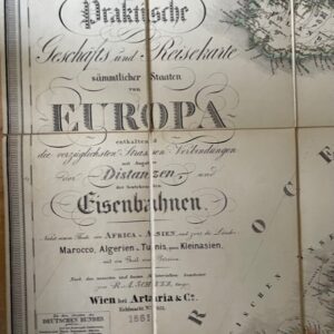
European Railway map, Vienna 1861
£165.00£150.00 Add to cart -
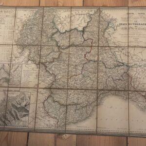
SARDIN IA. a partially coloured folding Italian map of the Kingdom of Sardinia, 1851
£60.00 Add to cart -
Sale!
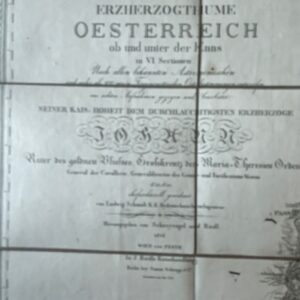
Map of Austria from the Napoleonic period, dated1814
£400.00£350.00 Add to cart