


")
")
")
")
")
TYROL. A Geman folding map of southern Germany and the Tyrol, probably 1850s
£20.00
Reise Karte durch Südbayern, Tyrol, das lombardisch – venetianische Königreich, Salzburg, und Salzkamemergut. Joh. Minsinger in München [Munich] no date but reference to Lombardy a a kingdom dates it to before 1861.
Attractive folding map, coloured in outline, 18½ x 21 ins [46 x 55 cm] unfolded, linen-backed and folding down into original cloth covered boards, 6½ x 4½ ins [16 x 11cm]. Decent clean condition internally but the old replacement spine very faded. It extends from just north of Munich south as far as Venice and Milan. aug8/1
1 in stock
Related products
-
Sale!
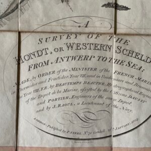
Survey of the Western Scheldt, published in London 1804
£775.00£690.00 Add to cart -
Sale!
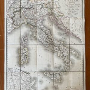
ITALY. A route map of Italy, published in Paris in 1824
£190.00£170.00 Add to cart -
Sale!
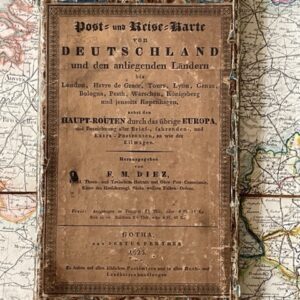
GERMANY. Folding map by F.M. Diez in original slipcase, 1825
£125.00£110.00 Add to cart -
Sale!
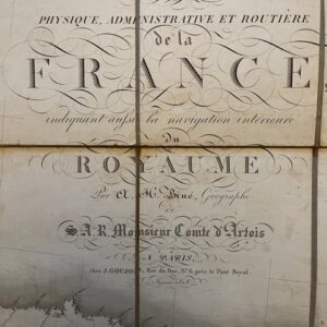
A Louis XVIII post restoration folding map of France, 1818
£265.00£230.00 Add to cart