View basket “EUROPE. A large folding map of 1836 with French text.” has been added to your basket.
Sale!
Map of Austria from the Napoleonic period, dated1814
£400.00£350.00
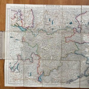
Charte von dem Erzherzogthume Oesterreich ob und unter der Enns in VI Sectionen nach allen bekannten Astromischen und mehr als 100 neuenTrigonometrischen Orstbestimmungen Entworfen aus achten Aufnahmen gezogen und bearbeitet. Schreyvogel und Riedl [Wien und Pesth] 1814. Folding Map of the Archduchy of Austria.
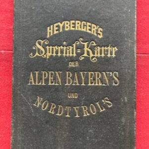
A large engraved, linen-backed, uncoloured, contoured, folding map of north western Austria [including Vienna], dissected and sectionalised in 48 sections to form one large, linen backed sheet, 179 x 102cm unfolded. The map is edge bound in green linen and bears lable of the Viennese retailer D’Artaria & Comp.The map, which is exceptionally clean and bright, folds to a size of 22 x 17cm and fits into its original marbled paper covered slip case. The case has a black leather gilt spine, titled to give the appearance of a book when on the library shelf. about a quarter of the lower leather of the spine is lacking but there is little other wear to the case. The map extends from Dillmanning and Burghausen on the Bavarian border in the west to Pressburg on the Hungarian border in the east. The other surrounding states – Bohemia, Steyermark and Markgraft Hummaehren are indicated but the areas left blank. As well as the impressive title at top left in German the map has an abbreviated version in French lower right. A map produced towards the close of the Napoleonic Wars shortly before the Cogress of Vienna. mar8/2