


Russian map of 1806, the lower half only of a good map from the Napoleonic period
£45.00
The Russian Dominions in Europe drawn from the latest Maps printed by the Academy of Sciences, St. Petersburg; revised and corrected with the Post Roads & New Governments, from the Russian Atlas of 1806; by Jasper Nantiat. W. Faden [London] June 4th 1808.
The southern sheet only of a linen-bakced folding map extending to 37 x 22 ins, coloured in outline and folding down to a size of 11 x 7½ ins [28 x 19 cm]. The map extends from the western shores of the Black Sea to the Sea of Aral in the east and from Solensk in the north to the tip of Asia Minor in the south. There are the usual small holes in the linen at intersecting folds and a couple of tears to the linn folds not affecting the printed areas. We seldom come across Russian maps from this period. mar 19/2
1 in stock
Related products
-
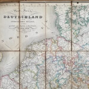
Germany, an 1838 folding map of the area and bordering states.
£95.00 Add to cart -
Sale!
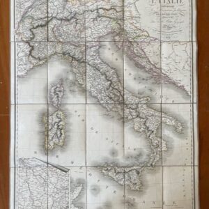
ITALY. A route map of Italy, published in Paris in 1824
£190.00£170.00 Add to cart -
Sale!
FRANCE. A folding route map of 1828
£125.00£110.00 Add to cart -
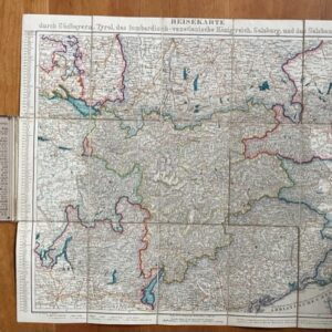
TYROL. A Geman folding map of southern Germany and the Tyrol, probably 1850s
£20.00 Add to cart