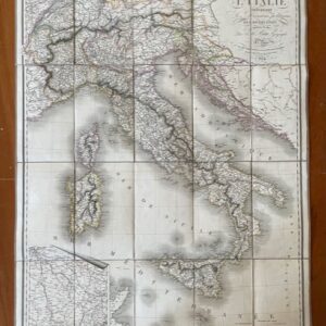
View basket “Italy. A good folding map of the whole of Italy and Switzerland, 1836. Printed in French and published in Paris.” has been added to your basket.
Sale!
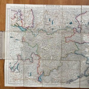
A special German map of the Bavarian Alps and North Tyrol, late 19th century.
£65.00£45.00
Heyberger’s Special Karte Der Alpen Bayerns Und Nordtyrols Von Der Zugspitze Bis Zum Kaisergebirge. Folding Map of the Bavarian and Tyrolean Alps. May & Widmayer [München / Munich] no date
The 27 plate folding map is dissected, linen mounted and has some colouring and contour shading. It extends to 32½ x 20 ins [82.5 x 51 cm] when unfolded. It folds down to a size of 7 x 3½ins [17.5 x 9.5 cm] and has gilt titled black cloth boards attached to the end plates. There is also a map of Starnberger See on the verso of one plate. There is no date to the map but it is probably from the third quarter of the 19th century. It is clean and sound. An attractive map of the mountainous region. mar6/3