


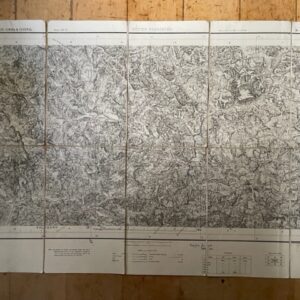
Large scale 1 inch map of parts of Surat, Broach, & Baroda, 1879 revised to 1901
POA
BOMBAY. Parts of Districts Surat & Broach & Baroda State. No 46 C/ 11 & 15 (Old No 129]. Survey of India [Calcutta] 1879 with corrections to 1901.
A 36 x 25 ins uncoloured map on ascale of 1 inch to 1 mile, surveyed in seasons 1875-5, of a coastal area on the Gulf of Cambray with estuary of the Kim River to the north of the map and the state of Baroda lies in the south. The linen backed map is clean but has a few tears along the folds affecting the linen but not the printed areas. The map folds down to 8½ x 7½ ins and has marbled endpapers with a printed label to the upper side with ms title Sayan & Kim.feb26/1 SOLD 16th June 2022
Sold
Related products
-
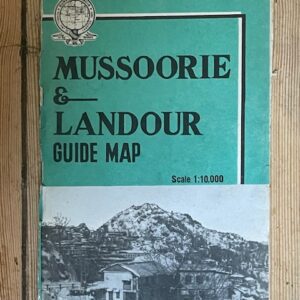
MUSSOORIES & LANDOUR. Large scale folding coloured map of the former hill stations by the Survey of India, 1968
£18.00 Add to cart -
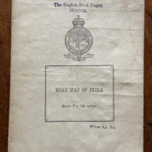
INDIA. Road map on a scale of 1 inch to 50 miles, printed around the time of independence
POA Read more -
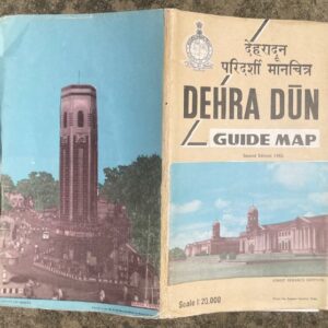
DEHRA DUN. Large scale folding coloured map of the town and area by the Survey of India, 1982
£25.00 Add to cart -
GARHWAL & ALMORA 1 inch map of 1873 in use by a hunter in 1946
£55.00 Add to cart